In 2014 Transport for NSW was undertaking an ambitious overhaul of their transportation wayfinding infrastructure throughout New South Wales and the capital Sydney, a city with a population of some 4.5 million.
The program includes the implementation of an integrated signage system across all transport modes including wayfinding principles aligned with maps, websites, apps, digital information systems and other communication channels.
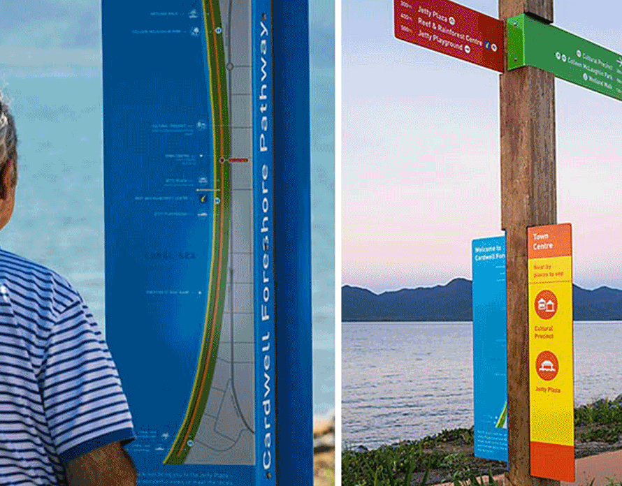
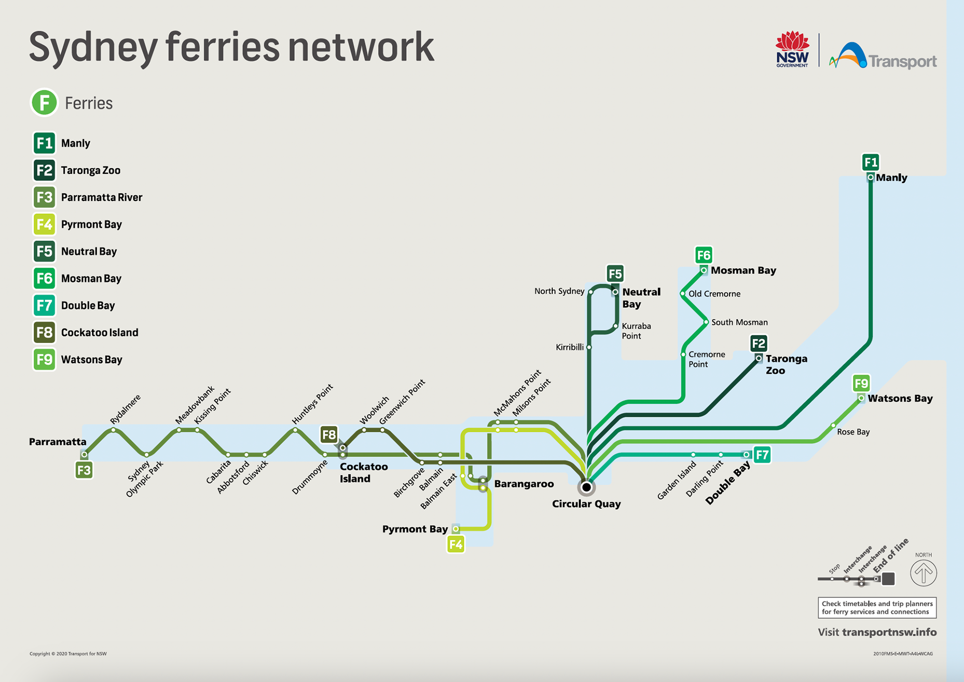
Working in close collaboration with TfNSW, Dotdash undertook the challenge of designing a consistent, recognisable and flexible wayfinding system for deployment across the entire Sydney Light Rail and Ferry networks.
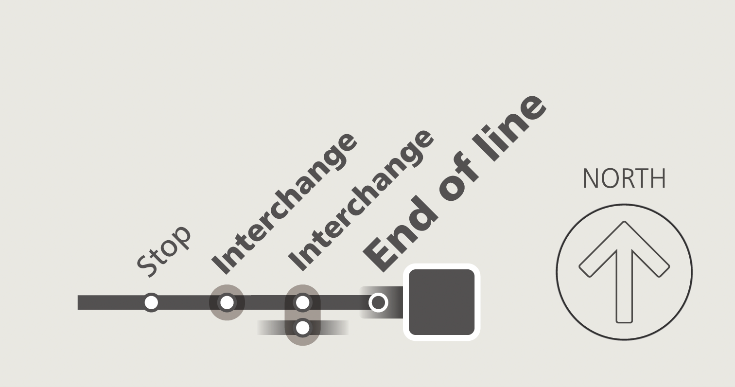
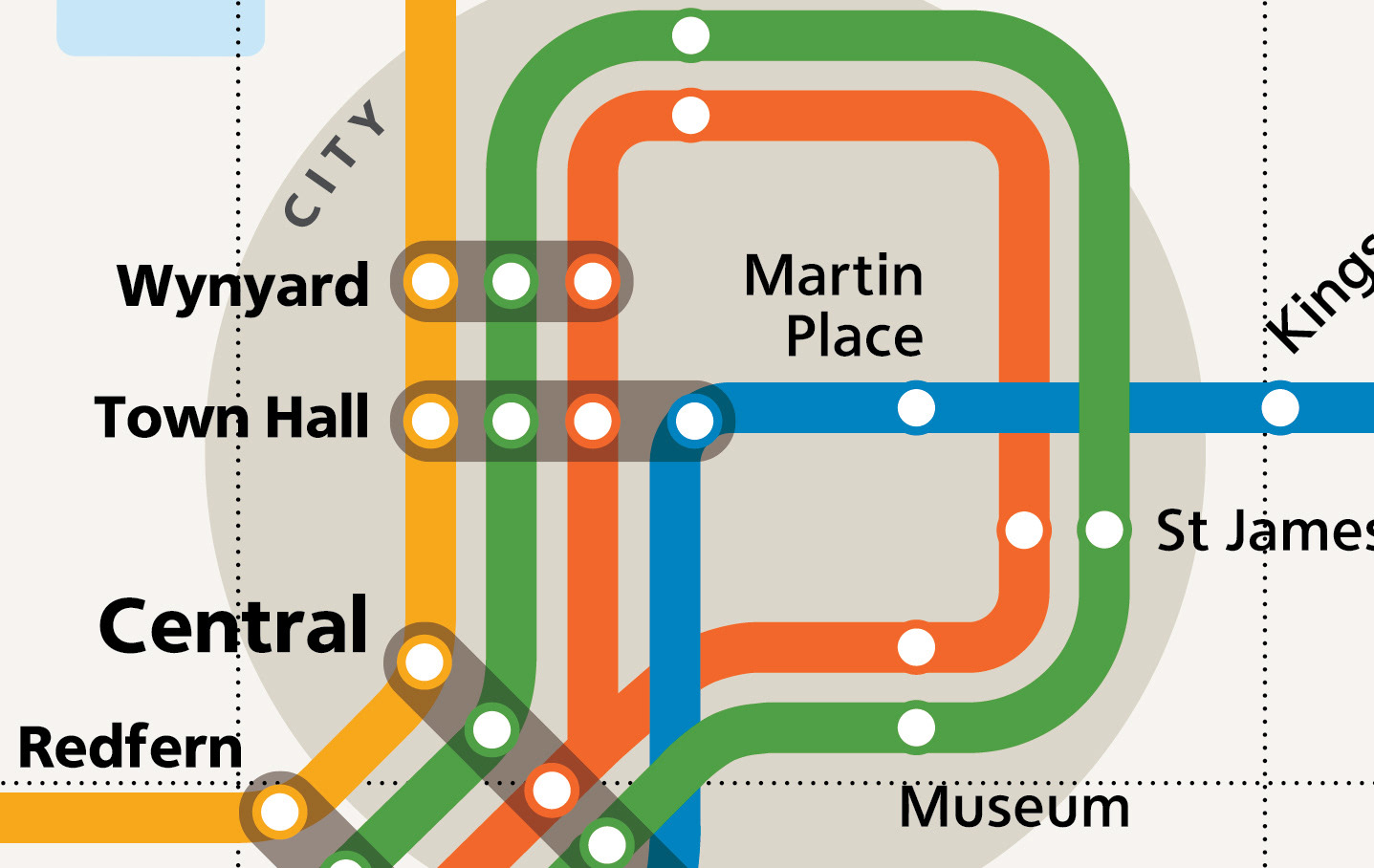
I was in charge of the re-designing the transport maps. I came up with the idea of using transparent device for interchange.
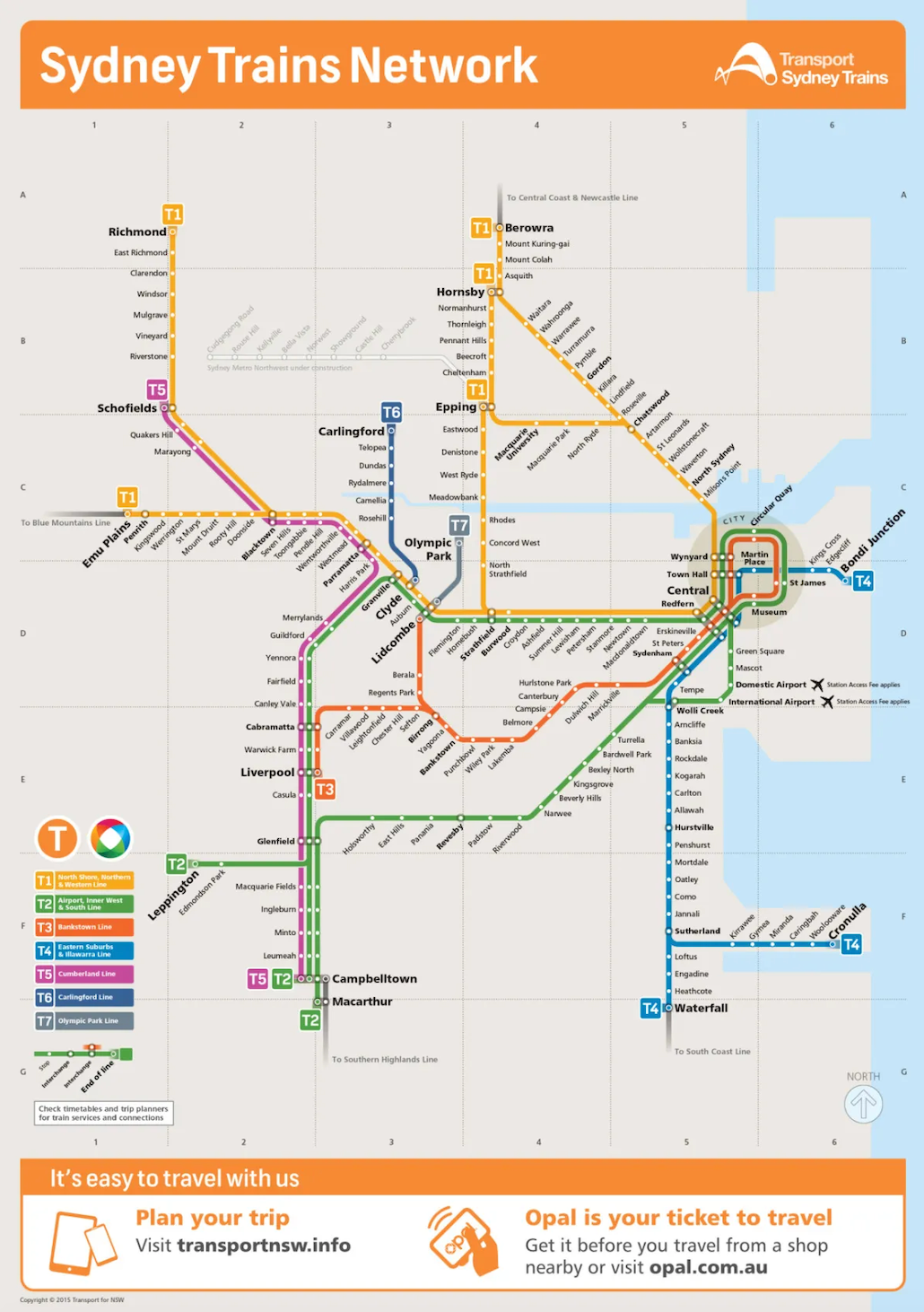
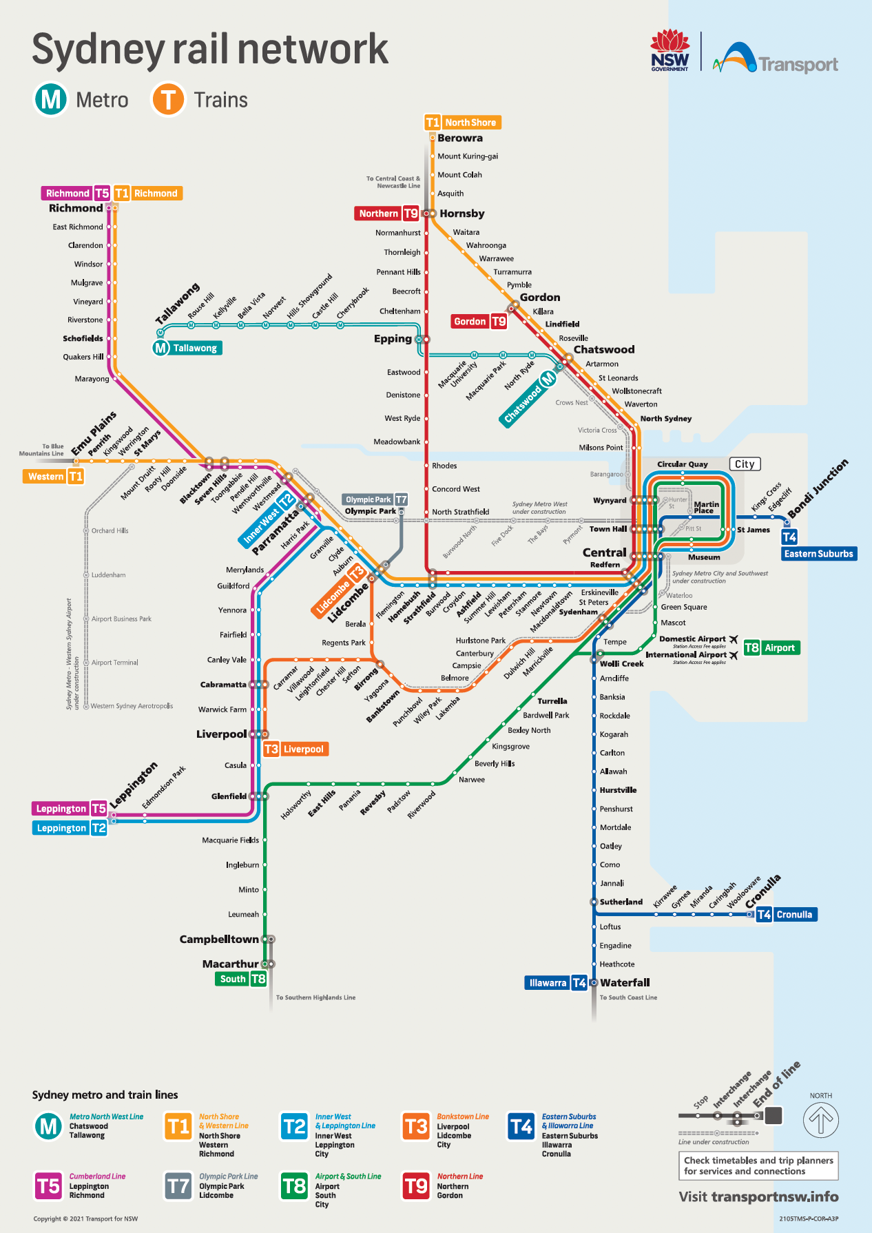
Sydney´s public transport system features a comprehensive network of train, bus and ferry services. Light rail lines, airport links, sightseeing buses and text services complement the network.
Project Team: Heath Pedrola, Erin Stromgren, Larraine Henning, Keith Sullivan, Domenic Nastasi & Mark Ross, Agata Dworaczek